elevation app on App Store search trends
1 place
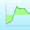
08.10
Current results for elevation app search on App Store
| #1 |

|
Elevation App from charlotte, nc every weekend. |
| #2 |

|
Elevation Church App is going on in the life of elevation chruch. |
| #3 |

|
Runtastic Altimeter GPS PRO climbing, mountain biking. runtastic terms of service: https://www.runtastic.com/in-app/iphone/appstore/terms runtastic privacy policy: http://www.runtastic.com/in-app/iphone/appstore/privacy-policy |
| #4 |

|
Flashlight for iPhone + iPad continued use of the flash may dramatically decrease battery life. |
| #5 |
|
Elevation - Altimeter Map or input the address/location name. you can also find the elevation of your current location by using online database, built-in gps, or barometer on your device. elevation data benefits flood prevention, |
| #6 |

|
Travel Altimeter & Elevation for determining altitude for medical reasons. |
| #7 |

|
Strava: Run, Bike, Hike renew at the same cost. terms of service: https://www.strava.com/legal/terms privacy policy: https://www.strava.com/legal/privacy |
| #8 |

|
Elevation Christian Church CO church with others! |
| #9 |

|
Runtastic Road Bike GPS version) - track bike tours via gps: distance, duration, speed, elevation gain, pace, calories burned, etc. - live tracking & cheers: go live and show your friends where and how fast |
| #10 |

|
Compasser-GPS&Elevation app me a message in the app store |
| #11 |

|
onX Hunt: GPS Hunting Maps or want to request new features? contact us at [email protected] |
| #12 |

|
Elevation For Real surveyor or engineer, when dealing with flood risk. |
| #13 |

|
Life Elevation Church App with the subsplash app platform. |
| #14 |

|
Elevation Community Church bible, and more! |
| #15 |

|
GPS altimeter - professional elevation measurement tools climbing, mountain biking and so on. contact customer service: welcome feedback [email protected] |
| #16 |
|
Elevation Chart - Draw Profile View by Touchs connection. ===== video tutorial ===== pick one of the following: • https://appbead.com/app-elevation-chart.html • http://youtu.be/o1t9-prx9dg |
| #17 |

|
My Altitude in outdoors. by default, it uses device sensor to determine the elevation from see level, but you also have the option to use noaa data files to get the altitude of |
| #18 |

|
Speedometer. GPS mph (miles per hour) or km/h (kilometers per hour). the elevation can be displayed in meters or feet. ***once the app is open for a couple minutes gps accuracy will greatly |
| #19 |

|
Elevation Church UT around us. for more information, visit our website at www.elevation.cc |
| #20 |

|
inRoute - Intelligent Routing gpx and kml files • create custom routes based on weather, elevation and curviness, or build your own route from available alternates on each leg of a route • interactive charts showing |