maps measure on App Store search trends
Current results for maps measure search on App Store
| #1 |

|
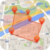
Measure Map Lite to measure fields in the countryside (argentinean patagonia). the satellite maps associated with this extra precise measure tool simplifies my work in a way i could not even dream of. |
| #2 |
|
Distance Measure having three or more points as its corners. it uses online maps so it needs an internet connection. tap and hold to set a new waypoint, tap the options icon to read |
| #3 |
|
Geo Measure - Map Area / Distance Measurement as kml. these kml files are also available via itunes. |
| #4 |

|
map measure planimeter : land area and distance map. just click on the map to add different points - maps measure will then calculate the distance and area. you may be an architect, a sports enthusiast or a geography hobbyist. |
| #5 |
|
Planimeter for map measure gps running in the background can dramatically decrease battery life." |
| #6 |

|
Measure Map - By Global DPI to measure fields in the countryside (argentinean patagonia). the satellite maps associated with this extra precise measure tool simplifies my work in a way i could not even dream of. |
| #7 |
|
Planimeter Pro for map measure gps running in the background can dramatically decrease battery life." |
| #8 |

|
DistancePinner active subscription period more information: https://myice92.com/distance privacy policy: https://myice92.com/privacy-policy terms of use: https://myice92.com/terms-of-service |
| #9 |

|
Running Distance Tracker - GPS Run Walking Tracker consult your physician or doctor before starting any fitness program. |
| #10 |

|
Planimeter shape. ▫ tap point to insert or delete. special thanks: riccardo moleri gerhard schultheiß |
| #11 |

|
Best Area existing area possible navigations: - apple maps - google maps - navigon - waze - tomtom |
| #12 |
|
GeoMap - Field Area Calculator distance . four types of map view * normal * satellite * terrain * hybrid |
| #13 |

|
Finger Measure Free - Map Area & Distance Measurement yd², acre) ✔ unit of distance ( kilometer, feet, yard, mile) |
| #14 |

|
Measure distance on map. Land accurate data considering local laws address the local geodesic services. |
| #15 |

|
Map Elevation and Altitude Tool for Height Measure location again. choose to display the unit in meters or feet. |
| #16 |

|
DrawArea - Measure area result may be less accurate when far from the equator. |
| #17 |

|
GPS Area Measurement Lite שטח ווייַטקייט אַנגלע באנד טערראַין מאפע טראַקינג פאַרם דאַך אַגריקולטורע |
| #18 |
|
GPS Map Ruler – Measure distance & area tourism. important features: *measure wherever you want to measure with high accuracy *multiple maps are available *measure the straight distance between points contact us:[email protected] |
| #19 |

|
Measure Map Pro use * for iphone and ipad * apple or g00gle maps with extra zoom level. * displays maps view: map, satellite, hybrid and terrain. * undo and redo operations as needed |
| #20 |

|
Planimeter GPS Area Measure land area and distance / length calculations, land survey or maps are involved. if you have any question about planimeter and its functionality, please check how to use quick guide: |